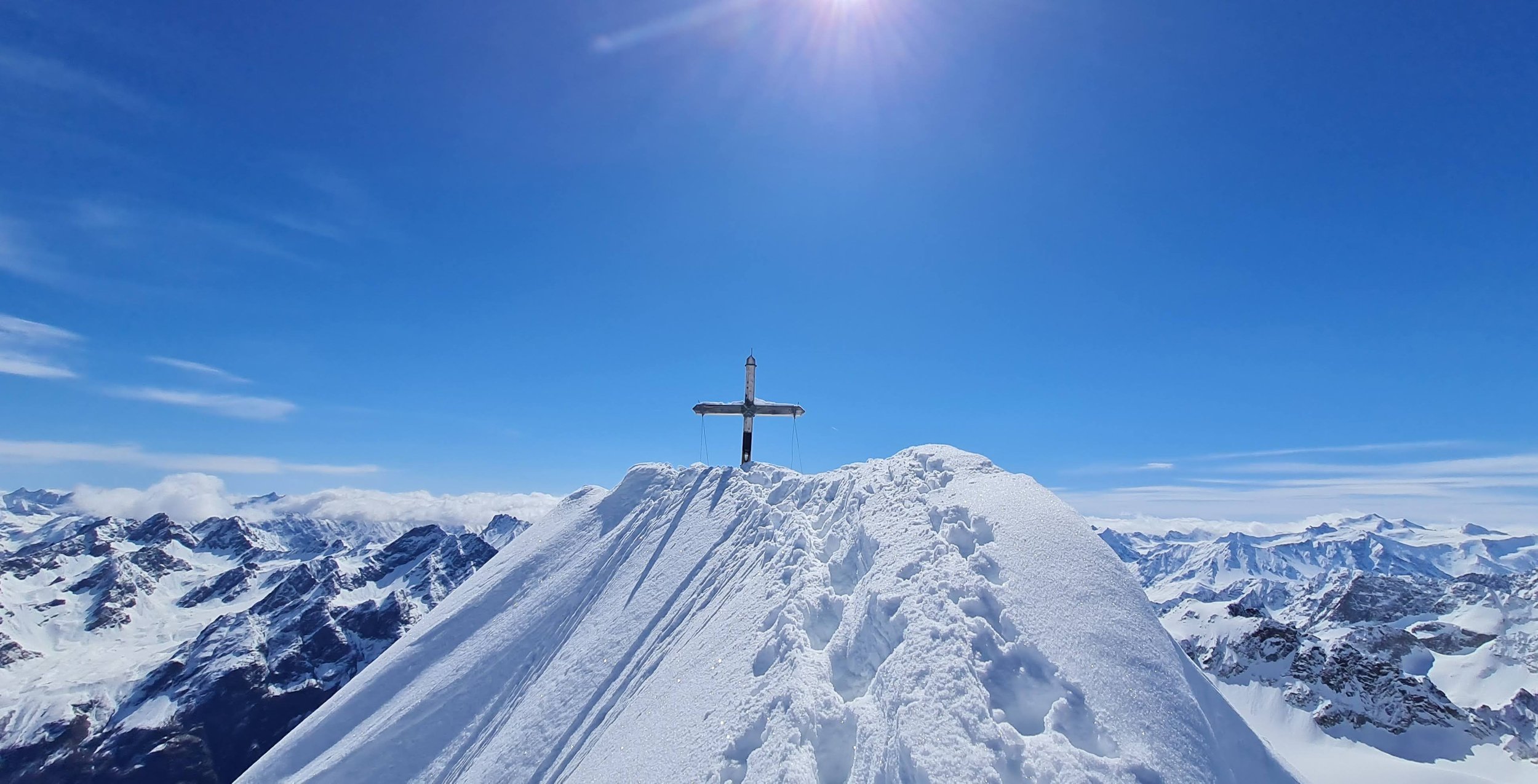
Gsallkopf (3278m) from Kaunerberg
Technical difficulty: 8/10
Fitness: 8/10
Objective danger: 8/10
Landscape: 10/10
Busy: 2/10
An excellent panoramic summit in Kaunertal to a summit with moderately difficult skiing and challenging technical climbing sections at the summit. Including the tunnel crossing, it makes up for a great adventure!
Starting point: Parking at the beginning of toboggan run to Falkaunsalm
Ending point: Parking at the beginning of toboggan run to Falkaunsalm
Ascend: 1800vm / 6h
Exposition: North-west
The ski tour to the beautifully shaped Gsallkopf is certainly one of the most beautiful, challenging, and intricate ski tours in Tyrol. The summit is well hidden within the Kaunergrat, which separates the Kaunertal and Pitztal valleys. The ascent begins with a roughly 1 kilometer long hike through the Gallruth Tunnel before reaching some of the most beautiful skiing terrain. The final ascent is steep and exposed, leading to the exceptionally scenic summit.
Route:
From the parking lot, walk a few meters along the toboggan run, then immediately turn left diagonally towards the beautiful farmer's meadows near the Wiesenhof. Ascend in a north-northwest direction to the edge of the forest. Alternatively, follow the toboggan run up to this point, which you then leave after the 4th turn past a transmission mast. Keeping slightly to the right through a wooden gate, take a shortcut up to the toboggan run. Follow the run a few meters to the left, take another shortcut, and later continue left along the toboggan run towards Falkaunsalm. After a right turn at a clearing at an elevation of about 1870m, you reach an information board about the Kaunerberg irrigation system with a signpost next to it. Here, leave the toboggan run and follow the sign "Wasserweg-Gallruth Alm" to the right, walking without any elevation gain in a south-southeast direction along the well-marked trail for about 0.8 kilometers to the entrance of the Gallruth Tunnel.
Through the approximately 1.0-kilometer-long tunnel through a mountain ridge to the exit just before Gallruth. Cross a ditch and through a short stretch of forest in a southeast direction out to the expansive meadows in front of the Gallruth Alm. Here, turn left towards the southeast and ascend in numerous switchbacks over a seemingly endless, well-structured steep slope up to an elevation of about 2320m. Turn right (straight ahead, the ascent route continues to the Wallfahrtsjöchl), aiming directly for the Großen Dristkogel, and cross out onto a ridge where you can then clearly see the further ascent route towards Gallruthferner. Descend a few meters into a wide valley basin, again heading straight for the Dristkogel, and left of a prominent rock head through a small valley upwards and then right to the west of the Dristkopf through beautiful hollows up to the Gallruthferner.
Continue southward over this glacier up to a pass (transition between Gallruthferner and Gsallferner; 2880m). From the pass, ascend left over a formidable steep slope up to a ridge shoulder, where you can enjoy a fantastic view of the summit goal and clearly see the further route. To the right, follow the broad ridge in a gentle rise and fall in a south-southeast direction up to the ski depot before the first rock rise. On foot, angle right around a rock edge and left through a first steep couloir upward. After a short time, cross under rocks into the right steep couloir and ascend almost straight up through it, until just below the summit you reach rocky terrain again. Exit right onto the fairly exposed rocky north ridge and climb up in easy climbing (II) onto the narrow cornice of firn and over this last few meters flat to the summit cross at Gsallkopf (3278m).
Descend:
Follow the described ascent route up to the Gallruthferner. After that, depending on snow conditions, you can choose from several nice variations for the descent back to the Gallruth Alm. Then, go back through the tunnel, and continue for about two-thirds of the way on the flat approach path. At a clearing, take a shortcut to the left diagonally down to the toboggan run - from here, you could also directly ascend to the access path to the tunnel. However, the approach to the tunnel is easier to find as described above!
Photos by @the.running.nomad, @innsbruckalps, @bennibru and @max.kober


