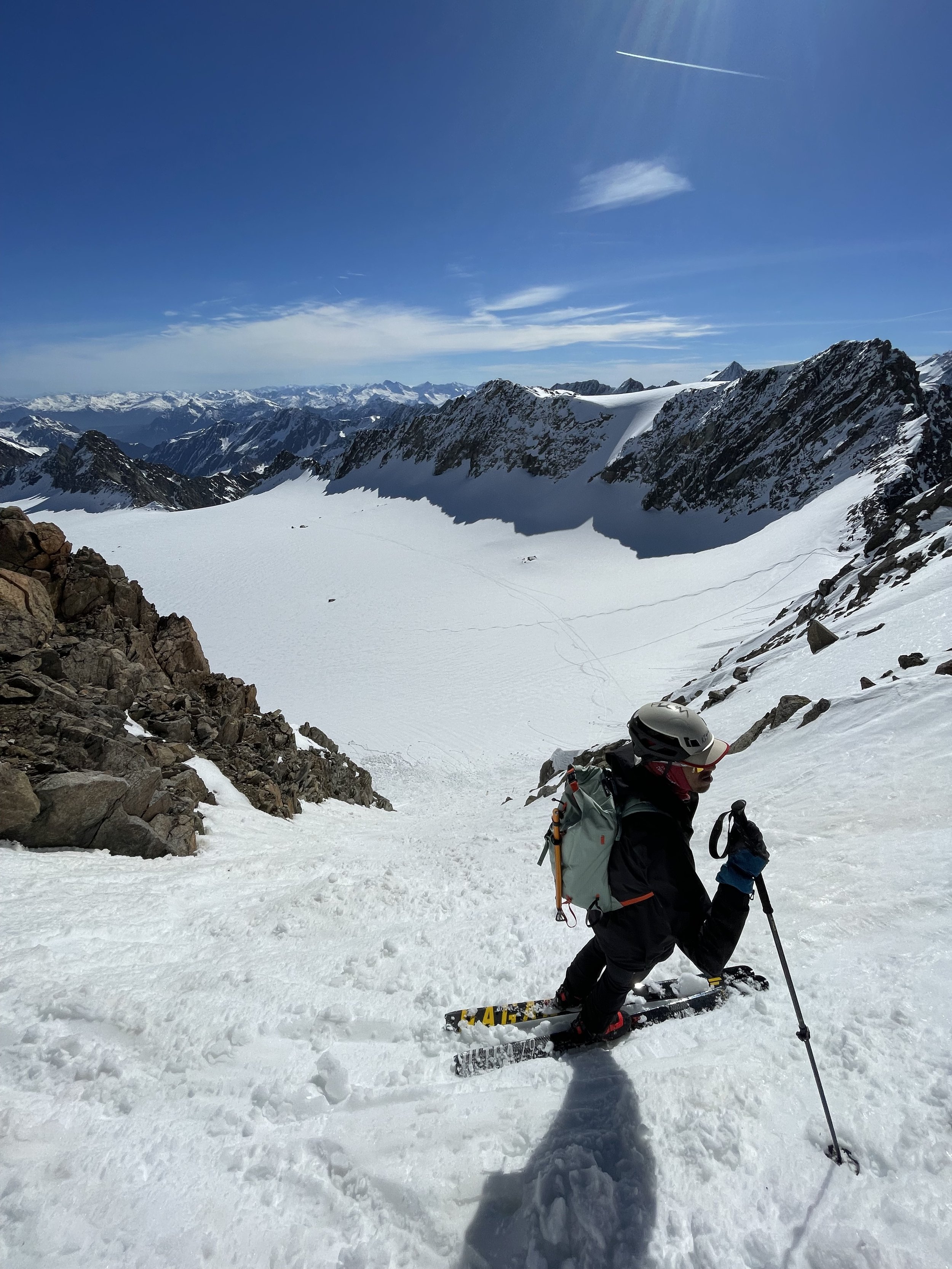
Traverse of Hinterer Brunnenkogel (3.325m)
Technical difficulty: 9/10
Fitness: 8/10
Objective danger: 7/10
Landscape: 10/10
Busy: 4/10
An amazing option for spring early mornings. Very technical and steep, requires being comfortable with some rock and snow climbing and steep descents, with good sense of planning.
Starting point: Lüsens
Ending point: Lüsens
Ascend: 1700vm / 6h
Exposition: The hard parts are South/West on the ascent and East descent couloir. Crux is back to Lüsens with North orientation.
A long and very varied ski tour to a normally not-so-busy 3000-meter peak. The described approach via the Längental and the Längental Ferner offers a great circular route, which includes beautiful skiing terrain, steep couloirs, and finally a short, partially exposed rocky ridge.
Route:
From Lüsens we follow most of the way to Längentaler Weißer Kogel. First heading south, with the Lüsenser Fernerkogel always in view, proceed until just before the end of the valley towards the material cableway. Here, turn right and, to the left of the gorge into which the Fernaubach has carved, ascend steeply through a wooded area to the Längentaleralm (1988 m). In the valley floor, with minimal elevation gain, head westward until the valley turns south below the hut.
Continue up the valley, about in the middle, over a short steep section to the junction for the Hoher Seeblaskogel, which you leave to your right. Alternate over glacier moraines and through hollows, usually staying in the shelter of the moraine ridges in the middle, depending on the avalanche risk, to the next steep section.
Ascend in several turns into the wide basin between Bachfallenkopf and Hinterer Brunnenkogel. Here leave the way to the Längentaler Weißer Kogel and make the short ascent to Längentaler Joch. Cross the south face of Hinterer Brunnenkogel and ascent up the steep colouir (at some places ~50 degrees) to the saddle. From here the summit is maybe another 100 vertical meters through mostly rocky climbing terrain to the north.
Descend:
Retrace your steps back to the saddle and ski down the opposite (east) side through a steep narrow colouir (also almost 50 degrees) to the Lüsener Glacier below. Ski across the entire glacier back north/ north-east. From the head of the glacier, the main skiing crux of the route takes you back down to the valley. This part has a lot of exposure to surrounding walls, it is very steep (~40 degrees in places) and can have tricky snow conditions. Use your skills and reading of the terrain to figure out the best way down the valley (don’t just follow old tracks as conditions depend heavily on current avalanche conditions and time of day).
Photos by @the.running.nomad, @bennibru, @innsbruckalps and @annaklam


