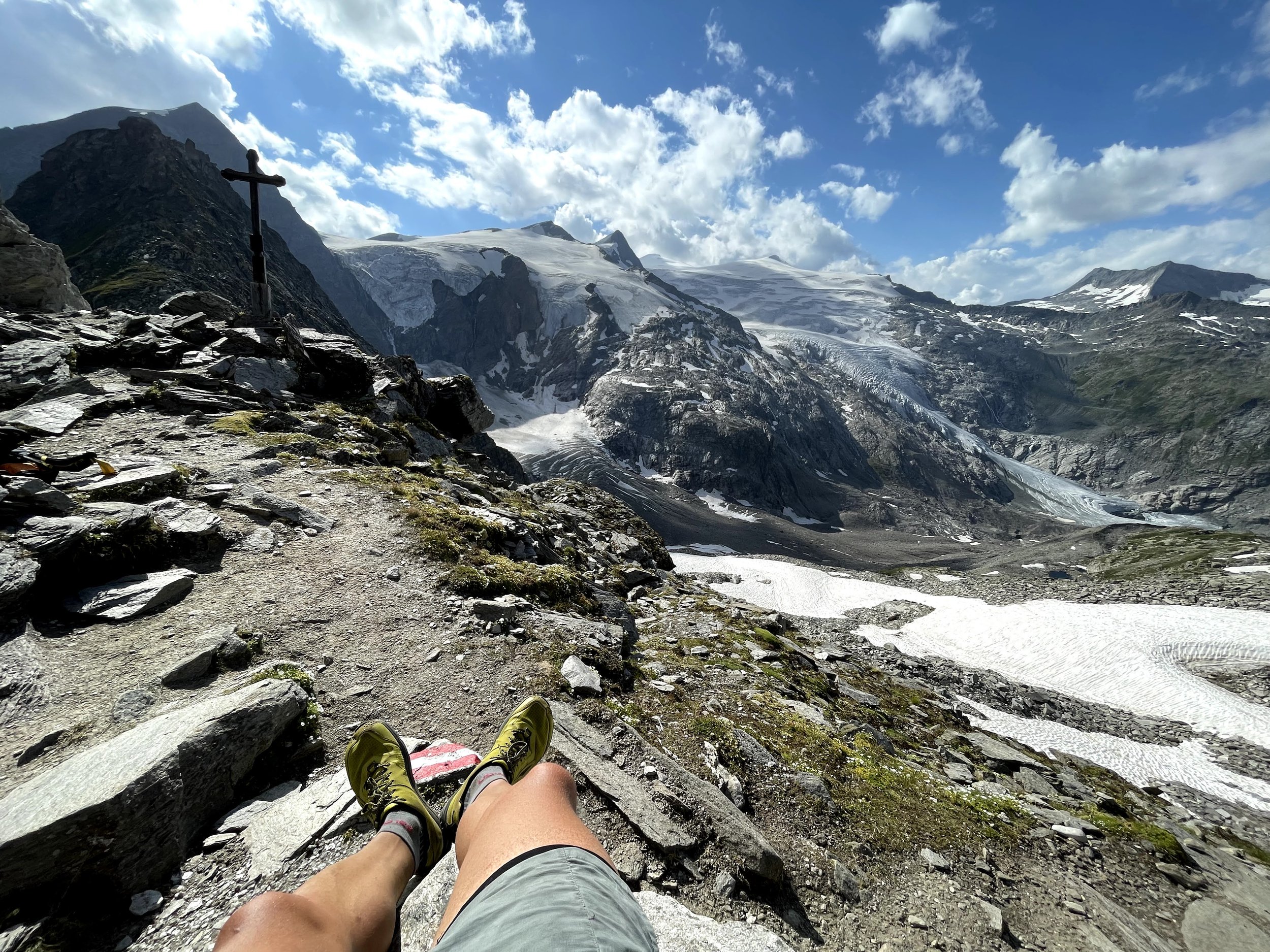
Venediger Höhenweg
Technical difficulty: 5/10
Fitness: 10/10 (or 5/10 if doing in stages)
Objective danger: 3/10
Landscape: 9/10
Busy: 3/10
Amazing high route in the Grossvenediger range in East Tirol. One long day or possible to split into 2 or 3 shorter stages.
Starting point: Ströden
Ending point: Matreier Tauernhaus
Length: 55km
Vertical: 4000m
Speed: mostly runnable trails, long day out at high altitude
Route:
Starting from the Ströden car park in Prägraten am Großvenediger, the route follows a forest road into the Maurertal to the base station of the supply cable car. The path leads through larch and spruce forests along the Maurerbach. After the upper Ochsnerhütte, you reach the Essener-Rostocker-Hütte via a former side moraine of the SimonyKees glacier: A small detour to the Lake Simony with a magnificent view into the glacier world is worth it!
The route continues along the Schwerinerweg a bit into the Maurertal, and then quickly gaining altitude in serpentines up to the Türmljoch (2,772 m). The descent leads evenly, well marked with cairns, and in the lower path section becoming steeper and steeper, to the oldest hut in the Eastern Alps, the Johannishütte.
Before starting the next section, the decision must be made whether to take the normal route via the "Schernesscharte" to the Neue Sajathütte, or the alternative via the "Zopetscharte" to the Eisseehütte. The normal route via the Sajatscharte had to be abandoned years ago due to latent risk of rockfall. Meanwhile, there is a new connecting trail (black mountain trail!) which is signposted as "Kreuzspitz-Höhenweg" and leads over the "Schernesscharte", which runs along the ridge below the Kreuzspitze. The Kreuzspitze (3,155m) can be reached from there in half an hour. As a reward for the ascent, a magnificent view of the highest mountains of the Venediger group awaits. The descent to the Neue Sajathütte then leads over a "rock trail" secured with steel cables. (demanding! and very much recommended :))
From the Neue Sajathütte, follow the Prägratner Höhenweg in an easterly direction on very smooth trails, and after a while you will reach the "Fenster", one of the most beautiful viewpoints of the Virgental. Always slightly ascending, you now follow the Timmeltal Höhenweg to the Eisseehütte. Then you run on a runnable traverse, more or less staying at the same altitude, below the Großer Hexenkopf, the Hoher Eichham and the Wunspitze, over the Eselsrücken (the “donkeyback”) to the Bonn-Matreier-Hütte.
Continue via two sharp passed - the Kälberscharte (2,791m) and the Galtenscharte (2,871 m) - to the Badener Hütte. This section is often only passable in high summer, depending on snow conditions. Only attempt in dry and snowless conditions as there is a chance of rockfall or wet avalanches.
From the Badener Hütte, climb up to the Löbbentörl pass, one of the most beautiful viewpoints along the way, then down towards Salzbodensee. This section if one of the most beautiful downhills in the Alps, with big glaciers of the Grossvenediger massive on your left and a smooth trail under your feet.
Continue a steep descent towards the small settlement of Innergschlöß and into one of the most beautiful valleys of the Eastern Alps. You can take a shuttle from here back to the parking lot or continue running another 7km or so down the valley yourself.
Try out this route, it is one of the best days of running you can do in Tirol, guaranteed!
Tip: leave a car at the end of the route before setting off. Almost impossible to get back with public transport.


