

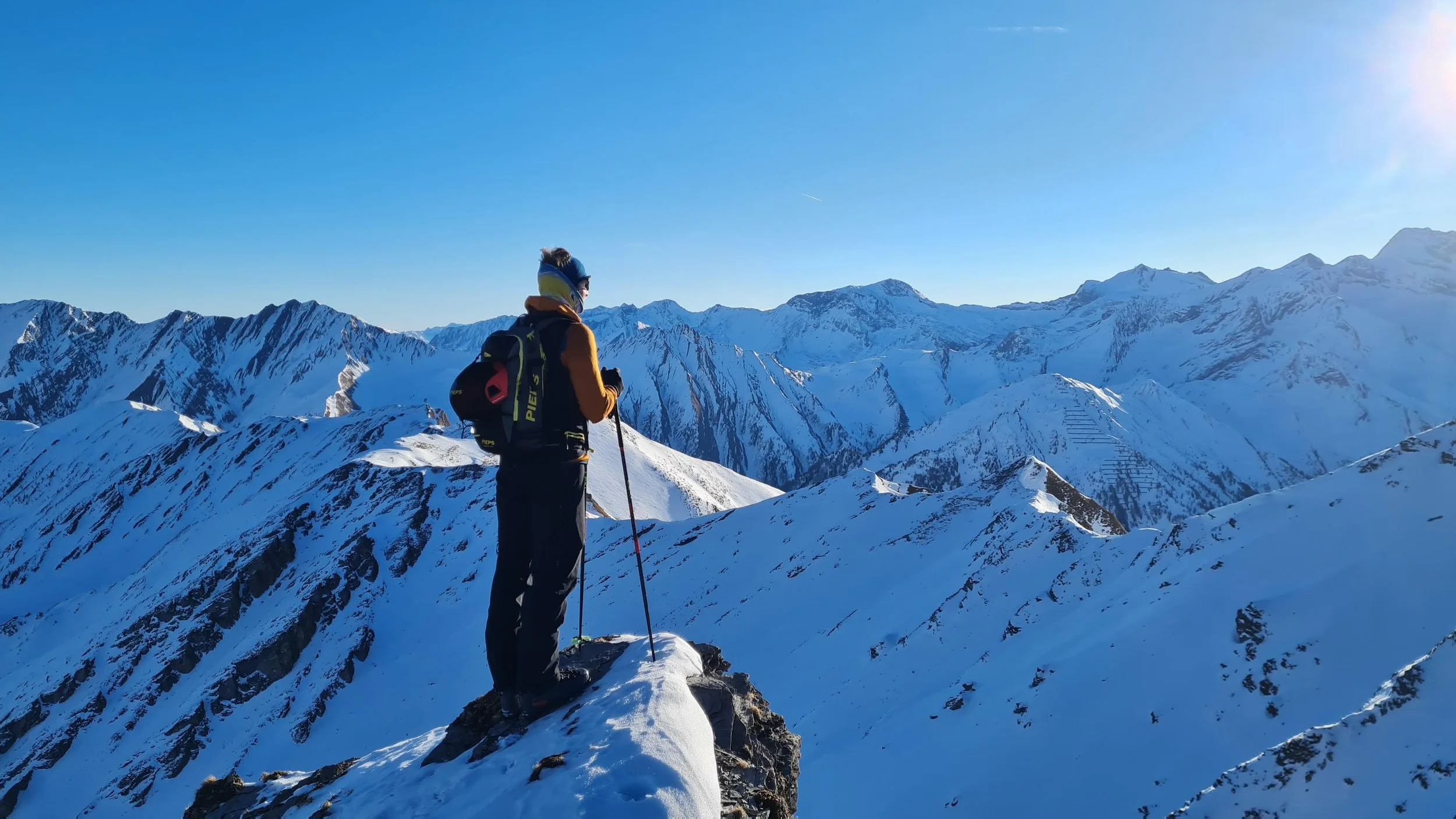
Schafseitenspitze (2604m) from Navis


Technical difficulty: 7/10
Fitness: 6/10
Objective danger: 5/10
Landscape: 7/10
Busy: 2/10
Ski tour from Navis to Stippleralm and via Stippleralm-Hochleger to Schafseitenspitze
Starting point: By the church in Navis
Ending point: By the church in Navis
Ascend: 1300vm / 4h
Exposition: North / North-east
The Schafseitenspitze is a challenging but stunning ski tour in the Navistal. With good and safe snow conditions, skiers can enjoy perfect descent slopes here. The ascent starts off easily and follows a relatively safe route up a broad, sunny ridge leading to the Stippleralm-Hochleger. From there, a magnificent ridge hike continues towards two rock pinnacles that block the direct route to the summit via the narrow ridge. Once this key section is overcome, the beautiful summit is reached shortly after.
Route:
To Stippleralm
From the church in Navis, follow the route to the avalanche beacon checkpoint and ascend on the forest road into the Weirichtal. After the first switchback, you typically take the steeper hollow path on the left, which shortens the forest road. After about 1.2 kilometers, at a flat section, the marked trail (signpost “Schafseitenspitze”) branches off to the right towards Stippleralm. The trail passes through a short forest section, crosses a wide meadow with an alpine hut below on the left, and then continues through another forest section above the Pliderlingbach stream, leading further into the valley to Stippleralm (1720m).
Ascent to Schafseitenspitze
Immediately after the alpine hut, turn right below the cableway and ascend in numerous switchbacks through a forest clearing to reach a broad, sunny ridge. Turn left and climb through sparse forest to the Stippleralm-Hochleger. From there, continue southward across exceptionally beautiful and well-structured ski terrain. Finally, with little elevation gain, follow the broad ridge directly towards two distinct rocky pinnacles that block the direct ascent route.
From Here, Three Variants for the Final Ascent to the Summit:
a.) In less stable conditions, ascend on foot to the first rocky pinnacle, then descend very steeply on the opposite side to the right into the west-facing slope. Traverse below the second rocky pinnacle and rejoin the ridge. This route is often heavily corniced and not always passable. It is quite alpine in character and slightly exposed!
b.) In very stable conditions, descend diagonally a few meters to the right before reaching the first rocky pinnacle into the valley side of the Vöstenalm. Pass around the western rock outcrops of the pinnacles and climb back up a steep northwest slope to regain the ridge. From here, ascend to the right of the ridge in a southerly direction, then traverse a relatively flat section above the entrance to the long, steep north-facing slope leading to the summit structure. The final meters are steeper again, leading up to the summit cross of Schafseitenspitze (2,604m).
c.) Also in stable conditions, continue further past the blocking rock pinnacles, keeping left and descending diagonally into the broad basin below the very steep, north-facing summit slope. Ascend this in numerous switchbacks to the summit ridge and then a few final meters leftward to the summit.
Descent:
In stable conditions: Descend via the very steep and long north-facing slope into the lower flat basin. From here, keep slightly to the right and descend through open larch forest via multiple steep gullies to the valley floor near Stippleralm. If conditions allow for good spring snow (firn), it can be better to keep slightly left from the flat basin and descend through very steep, east-facing clearings down to the valley floor.
In less stable conditions: Return via the rocky pinnacles and follow the ascent route back to Stippleralm. Then, continue along the ascent route towards Navis. Towards the end, it is often better to follow the broad forest road (with a short, easy counter-ascent) before making the final descent across a scenic meadow directly to the church.
Photos by @the.running.nomad and @bennibru