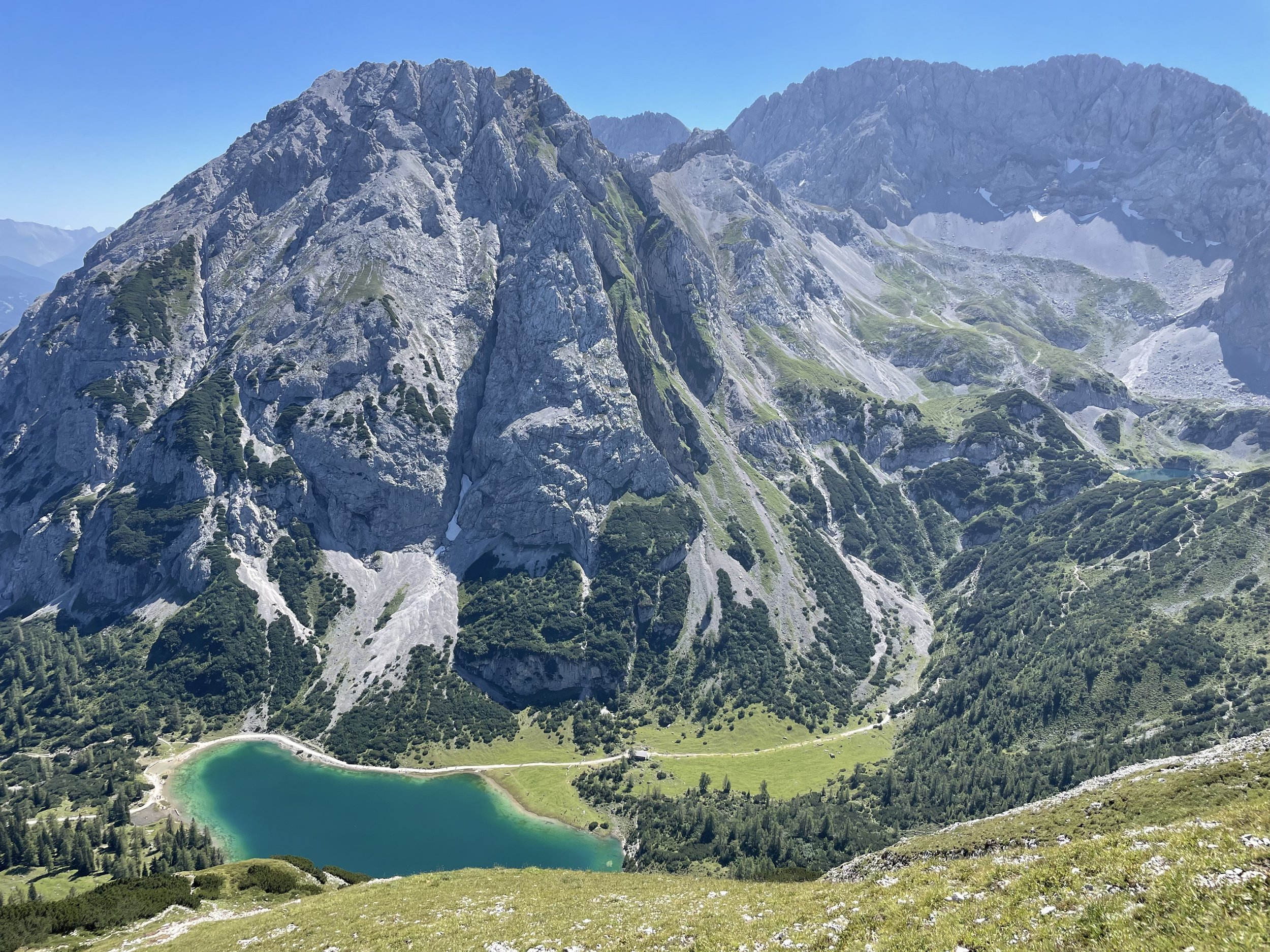
Ehrwalder Sonnenspitze (2416m)
Technical difficulty: 10/10 (II grade climbing)
Fitness: 6/10
Objective danger: 9/10 (lot of potential for falling rock)
Landscape: 9/10
Busy: 2/10 (10/10 in the valley)
A beautiful technical summit of Ehrwalder Sonnenspitze is a good option for days when you prefer technical terrain over distance. Great views throughout the loop.
Starting point: Ehrwald Almbahn
Ending point: Ehrwald Almbahn
Length: 15km
Vertical: 1400m
Speed: II grade climbing. Very technical apart from the last few kms.
Route:
We start from the parking lot at the Ehrwalder ALmbahn cable car and follow the signs towards Hoher Gang. We follow the trail up the river, than a little bit along a forest road and across some alpine fields until we connect to the Hoher Gang trail.
The trail starts climbing really steeply through the forest and gets more and more technical the higher we get. There are plenty of exposed sections secured by fixed cables. The trail offers great views towards the massif of Zugspitze, which will be visible for most of the day today.
The trail eventually flattens out and we arrive at a small plateau with a lake - Sebensee - at the centre of it. A whole cirque opens up in front of us and straight aheah, we continue to climb past the lake southwards towards the Coburger Hütte sitting above another beautiful lake - Drachensee. From here the tour gets noticeably less busy.
We continue west/north-west from the hut traversing across the plateau towards the south face of now clearly visible Sonnespitze. The trail passes some rolling hills before climbing steeply through a scree field towards the face. Here the fun part starts. The beginning of the trail is marked by a big red arrow and throughout the climb there are some red dots/arrows, some cairns and a few belay points visible along the way. The navigation could be really challenging in bad weather so take that into consideration.
The climb through the south face reaches up to II grade climbing difficulty. The rock is mostly of really good quality and the climbing is really fun, alternating between more scrambling sections and exposed traverse sections. The face is deceptively long, with some fake summits along the way. We eventually reach the summit ridge and the south summit, we a short exposed ridge connecting us to the main summit with the summit cross.
The descent is considerably less fun, with some challenging route-finding and a ton of lose rock, it requires a lot of focus. It gets less exposed as we descent, but not less technical and continues this way all the way back until Seebensee.
For variety, we can take a longer way down. First passing by the Seebenalm, with some chance to eat/drink something. Beware, it gets really busy on summer days. We then continue further down the forest road eastwards until Ganghofers Rast, where we turn left at the cross roads (north) and start the steep descent down the Immensteig. Some exposed sections and fixed ropes along the way should be familiar at this point :) .
Once we reach the bottom of the valley, the only section left is a nice runnable trail back to the parking lot.
Pro tip: take advantage of streams and lakes to have a swim on a hot day.
Photos by @the.running.nomad and @annikasuess


