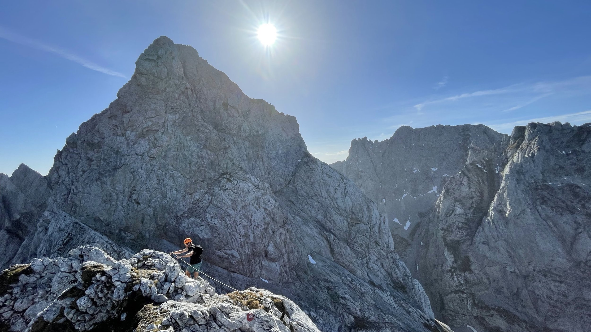
The Elmauer Halt and Elmauer Tor Loop
Technical difficulty: 10/10
Fitness: 8/10
Objective danger: 9/10
Landscape: 10/10
Busy: 3/10
HIghly technical loop through some of the best scenery of Wilder Kaiser mountain range - over the summit of Elmauer Halt and back through Elmauer Tor.
Starting point: Wochenbrunner Alm
Ending point: Wochenbrunner Alm
Length: 21km
Vertical: 2700m
Speed: Incredibly technical and exposed trails. Up to C-class Via Ferrata. (Helmet is a MUST, via ferrata set highly recommended)
Route:
We park at the Wochenbrunner Alm and start ascending steeply through the forrest following the signs to Gruttenhütte. The trail climbs up through thinning forest until the trees disappear completely and we come up on a small plateau next to the hut. From here, we follow the signposts towards Elmauer Halt. The trail gets increasingly rocky as it ascends towards the impressive walls in front of us. We pass through a large cauldron and reach the foot of the rock after about 800 vertical meters from the car.
This is a good place to put on a helmet, before we start climbing up the fixed ropes of Gamsängersteig via ferrata. It is mostly easy, with the hardest part being B/C difficulty, and leads us the remaining 400 vertical meters to the summit. You can check the topo here. It passes through a section of steel steps called the “Jägerwand-Treppe”, offering a hint of exposure coming later. A few hundred meters below the summit, we pass a bivouac hut - Babenstuber Hütte - before reaching the rocky summit of Elmauer Halt (2344m).
We leave most of the people at the summit, and in few meters realize why. This is where the real fun begins. We continue northwards on the ridge to the north side of Wilder Kaise, descending the mountain through the Kaiserschützensteig via ferrata. It is mostly easy climbing (A-B via ferrata, or I- UIAA climbing), with the hardest part being B/C. However, it is very very long and incredibly exposed the whole time. So prepare for very slow going and moving for 1-2 hours in a “no-fall-zone”. After we downclimb the first ridge from the summit, we can do a first short side-trip to the summit of Gamshalt (2291m). We continue moving up and down through the face and slowly descending until the terrain gets more brittle and solid rock transform into more and more lose terrain. We can make another short side-trip (around 200 vertical meters) to the summit cross of Kleine Halt (2116m).
We continue down very steeply through a tricky brittle terrain, with a visible drop below us. Just before reaching the drop, the trail traverses to the left (south) above the drop and eventually levels up before reaching the valley floor. With excitement of seeing a trail again, we can finally do some running and continue steeply down the valley for another 500-600 vertical meters before reaching the Hans-Berger-Haus. This is a great place to refill water if you haven’t found another water source.
Now we get to enjoy some ascending through easier terrain. A nice trail starts leading us back up east for about 600 vertical meters towards Stripsenjochhaus. We go over the pass the hut stands and descent a few hundred meters down the other side, before reaching the turn-over to Eggersteig - a trail leading up to Elmauer Tor. This is where smooth trails end again. The trail traverses the north face of Totenkirchl on a narrow ledge, until reaching the valley leading up the pass. It then turns north abruptly and starts ascending steeply again, through rocky and slaby terrain. The ascend slowly flattens out and can feel endless, despite the amazing views of imposing walls all around us. Once we reach the Elamuer Tor pass, our ascending for the day is over.
The trail leads us down southwards, very tricky and slipper at the begging and getting more runnable as we get lower. We see the Gaudeamushütte below us and work our way towards it. From the hut, it is just a few kilometers of runnable trails and forest roads back to the parking lot.
Pro tip: The route has almost no water between the huts, so bring enough with you.
Photos by @the.running.nomad and @innsbruckalps


