The Arnspitze Traverse
Technical difficulty: 9/10
Fitness: 8/10
Objective danger: 9/10
Landscape: 9/10
Busy: 4/10
A classic technical traverse on the boarder of Austria and Germany crossing the ridge around Arnspitze.
Starting point: Scharnitz Sonnenplatten Climbing Crag
Ending point: Scharnitz Sonnenplatten Climbing Crag
Length: 27km
Vertical: 2300m
Speed: The middle 5km take as much time as the remaining 22km :)
Route:
We start from the parking lot and run through few streets on the side of Scharnitz before joining a forest road trail following the left bank of the river northwards towards Germany. We follow this road for about 7km until we reach a trail turning left from the road (follow the GPS). The trail turns to head south-west and starts climbing towards the ridge. We climb steadily through the forest until reaching a saddle with cross-roads. We stick to the ridge and keep following it south-west.
After few more hundred vertical meters, we reach the first summit of the day - Riedkopf (1860m). The trail is mostly out of the trees now. We follow the ridge a little longer before a trail leads off to the east side of the mountain and traversing the Grosse Arnspitze under its imposing east face. We follow the trail until it start ascending again towards a small bivvy hut - Arnspitzhütte.
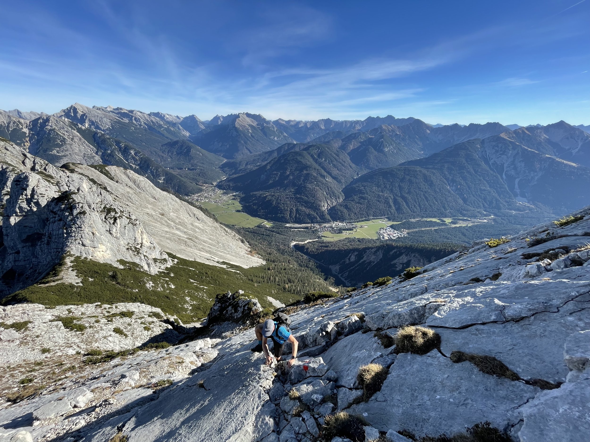
From here we continue steeply uphill back north-westwards towards the pre-summit, and after a short climbing section, the summit of Grosse Arnspitze (2196m). Here the real meat of the route begins. The trail is well marked and relatively easy to follow. We can see the long ridge in front of us and the trail is a combination of trying to get through the low pines and sustained sections of upclimbing and downclimbing terrain up to II UIAA in difficulty.
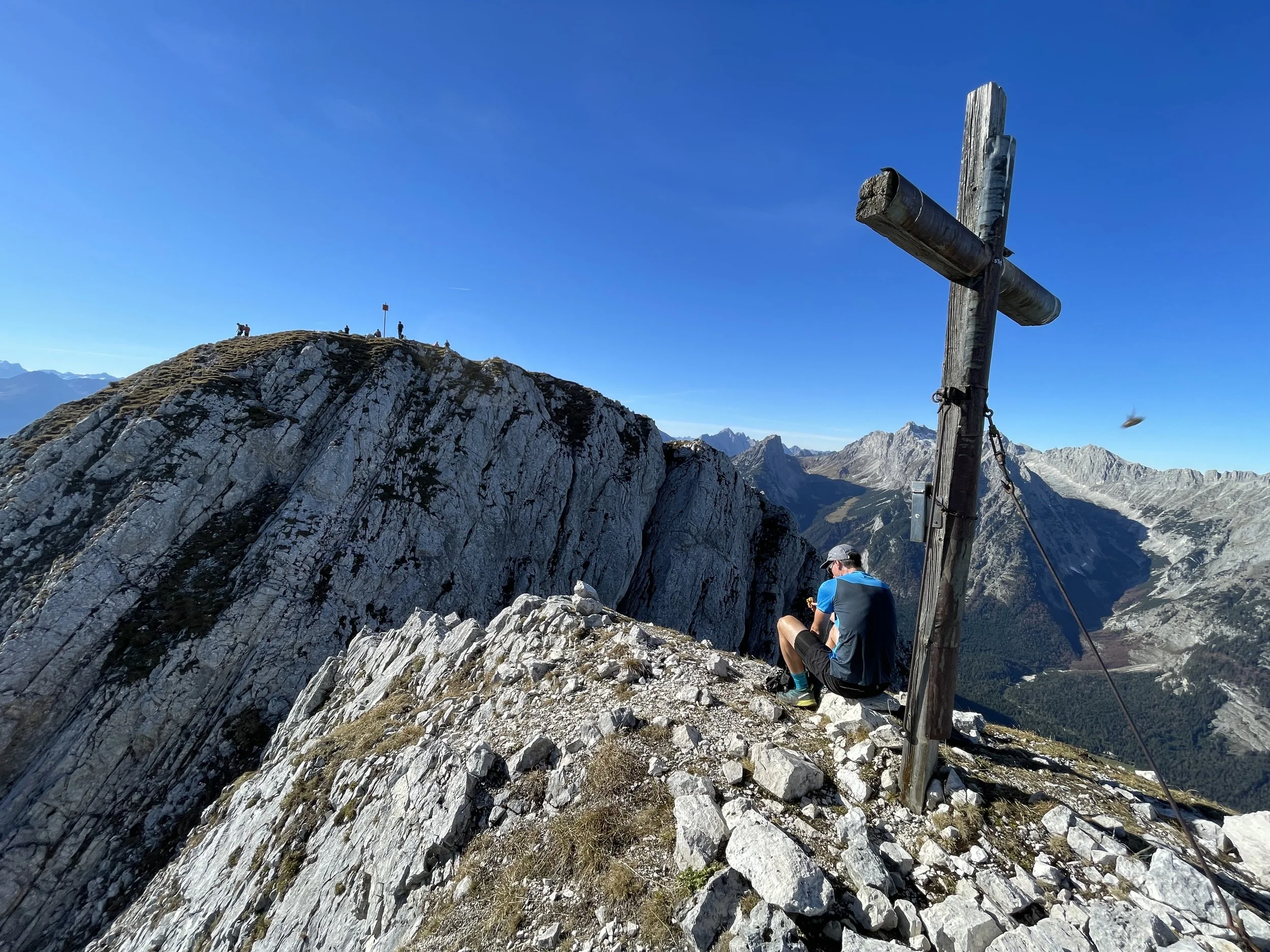
After the downclimb from the first summit, we reach a saddle before the Mittlere Arnspitze (2091m). We have a choice to go through the summit or bypass it on its right side. We highly recommend the summit route. It is a lot prettier and the bypass has a ton of loose rock. The crux of the summit way is right after the saddle, climbing through a short but very exposed rock band. After that the way to the summit is very technical but much less exposed. The trickiest part is downclimbing back from the summit cross.
The descent from the middle summit has a long down-climbing sections. Not hard but quite air-y and requiring a lot of focus. There is one more challenging summit in front of us. The trail follows the ridge through low alpine trees until we reach the final slabs of the Arnplattenspitze (2170m). The slabs look very intimidating from far away, but the ascent is manageable (not as hard as the other summits) and makes up for great pictures. Before we know it, we are standing at the summit cross.
Even though most of the scrambling difficulties are behind us, we have a very steep and technical descent still in front of us. First we have to follow the ridge still over a few less prominent summits. We cross over Weißlehnkopf (2002m), Arnkopf (1933m) and Zwirchkopf (1769m) before reaching a small old emergency hunting cabin. From here the trail starts descending really steeply south-west towards Leutasch. Once we manage the steep descent on a small trail we reach a river with first opportunity to fill up on water.
Our run is not over though, as we still have to get back over the mountain to our car. We follow the forest road another 400 vertical meters to north-east towards Hoher Sattle. Once on the pass, the uphills for the day are finally done and we can enjoy the few kilometers of flowy trails and forest roads following the Adlerweg trail back to the parking lot.
Pro tip: The whole ridge is without water so bring enough to get you through.
Photos by @the.running.nomad and @bennibru


