Via Mandani
Technical difficulty: 8/10
Fitness: 6/10
Objective danger: 4/10 (some exposed sections on the ridge)
Landscape: 7/10
Busy: 3/10
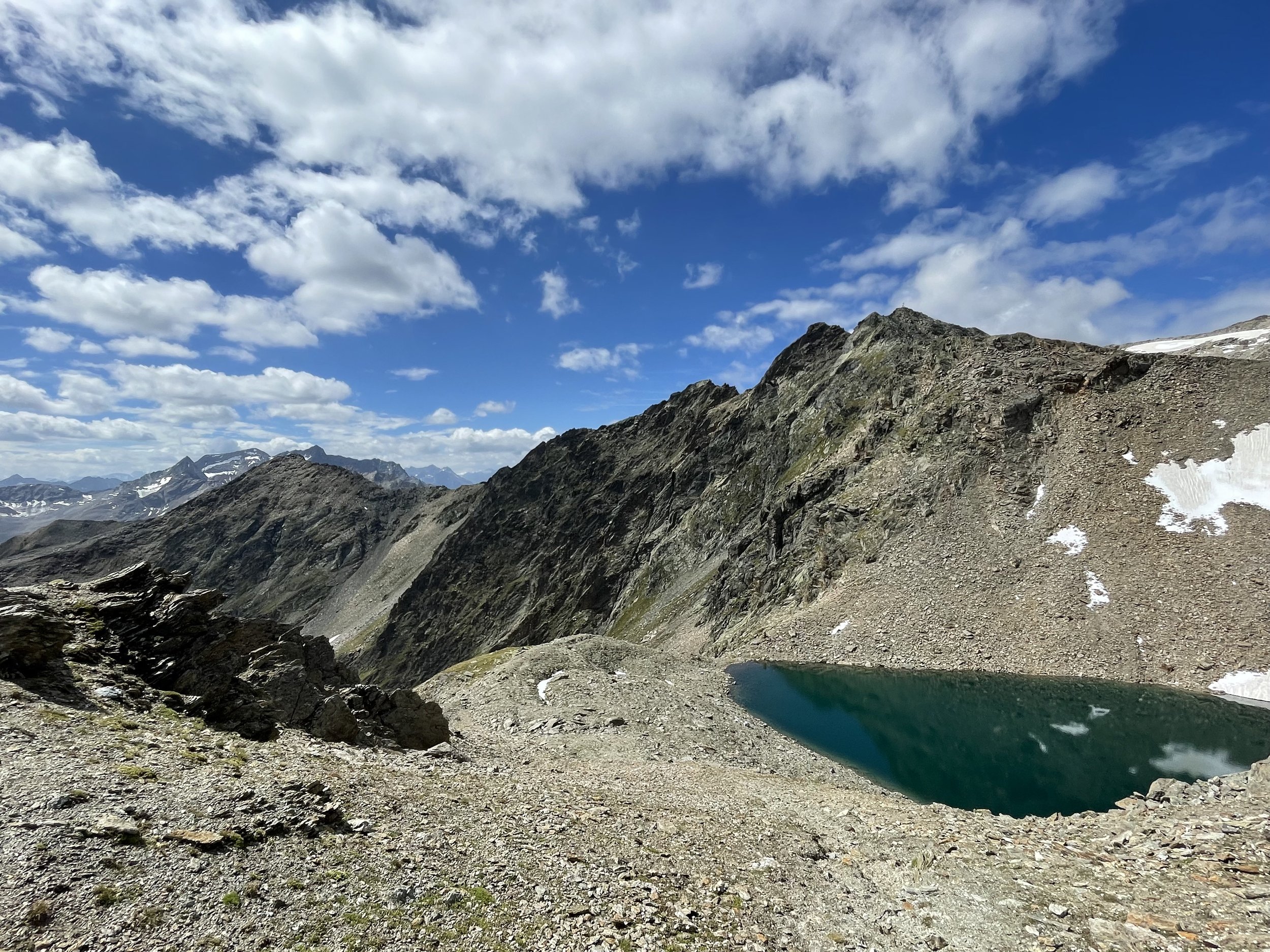
A nice round through the wide open valleys of Sellrain, with the Via Mandani route through the ridge between Gleischer Roßkogel and Zwieselbacher Roßkogel for some technical adventure.
Starting point: Parkplatz Gleirsch Alm
Ending point: Parkplatz Gleirsch Alm
Length: 22km
Vertical: 1600m
Speed: The ridge is a slow going, otherwise nice trails and a long time on the forest road.
Route:
Let's dive into today's running adventure, a route full of contrasts. Imagine this: a relaxed jog through a spacious valley and then a heart-pumping climb on a rocky ridge.
Our journey starts and ends at a parking lot in a town called Sankt Sigmund im Sellrain. As we set off, our path is a paved road, which folks use for sledding during winter. But don't get too comfortable, because after about a kilometer, right by the Gleirsch Alm, the pavement gives way to a winding forest road.
Keep going further and further up the valley, and eventually the Pforzheimer Hütte will emerge on a hillside to your right. Spotting the cable car that supplies the hut means you're about to leave the road for a proper trail, which zigs and zags its way up to the hut. And hey, if your legs need a break or you're feeling thirsty, this hut is a fantastic pitstop. Don't worry if you skip it now; we'll be coming back down this way.
The next part ahead is the upward trail leading to Gleischer Roßkogel (2994m). The trail gets steeper and steeper as you approach the ridge. Once you hit the ridge, turn right (N-NW), and follow the ridge until you reach the summit. Look out for an old red metal cross, a landmark, and a signpost marking the beginning of the Via Mandani, the highlight of our run (you can find the topo here)!
The Via Mandani ridge is very well marked and relatively easy to follow. The hardest sections are around 2 UIAA. There is a relatively exposed section through a rock wall towards the end, but it is equipped with iron steps, so the difficulty here is mostly the exposure.
You will pop up on the summit of Zwieselbacher Roßkogel (3080m) from the south. The route traverses a bit more along the ridge through a large boulder field and eventually offers a nice view over beautifully-coloured lake before starting a steep descent back to the hut.
You join the already-familiar trail a few hundred meters above the Pforzheimer Hütte. You backtrack your steps from here back through the valley and to the parking lot in Sankt Sigmund.
Photos by @the.running.nomad


